Navionics Platinum:
multi-dimensional Navionics mapping with 3D visualisation - satellite and aerial pictures - panoramic harbour pictures - harbour services and points of interest - dynamic tide icons
Navionics Gold:
exceptional detail - bathymetric lines - harbour plans - currents and tides - services - excellent coverage.
Navionics +:
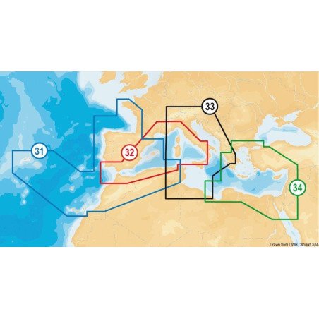
exceptional detail - bathymetric lines - SonarChart™ - Auto-routing - Plotter Sync - harbour plans - currents and tides - services - excellent coverage. Chose between 29.080.08 (Mediterranean Sea areas, Black Sea, Canary Islands and Azores) and 29.080.11 (empty). This latter can be downloaded by the final user with one of the XL9 Navionics + areas from navionics.com.
Navionics + Small:
exceptional detail - bathymetric lines - SonarChart™ - Auto-routing - Plotter Sync - harbour plans -